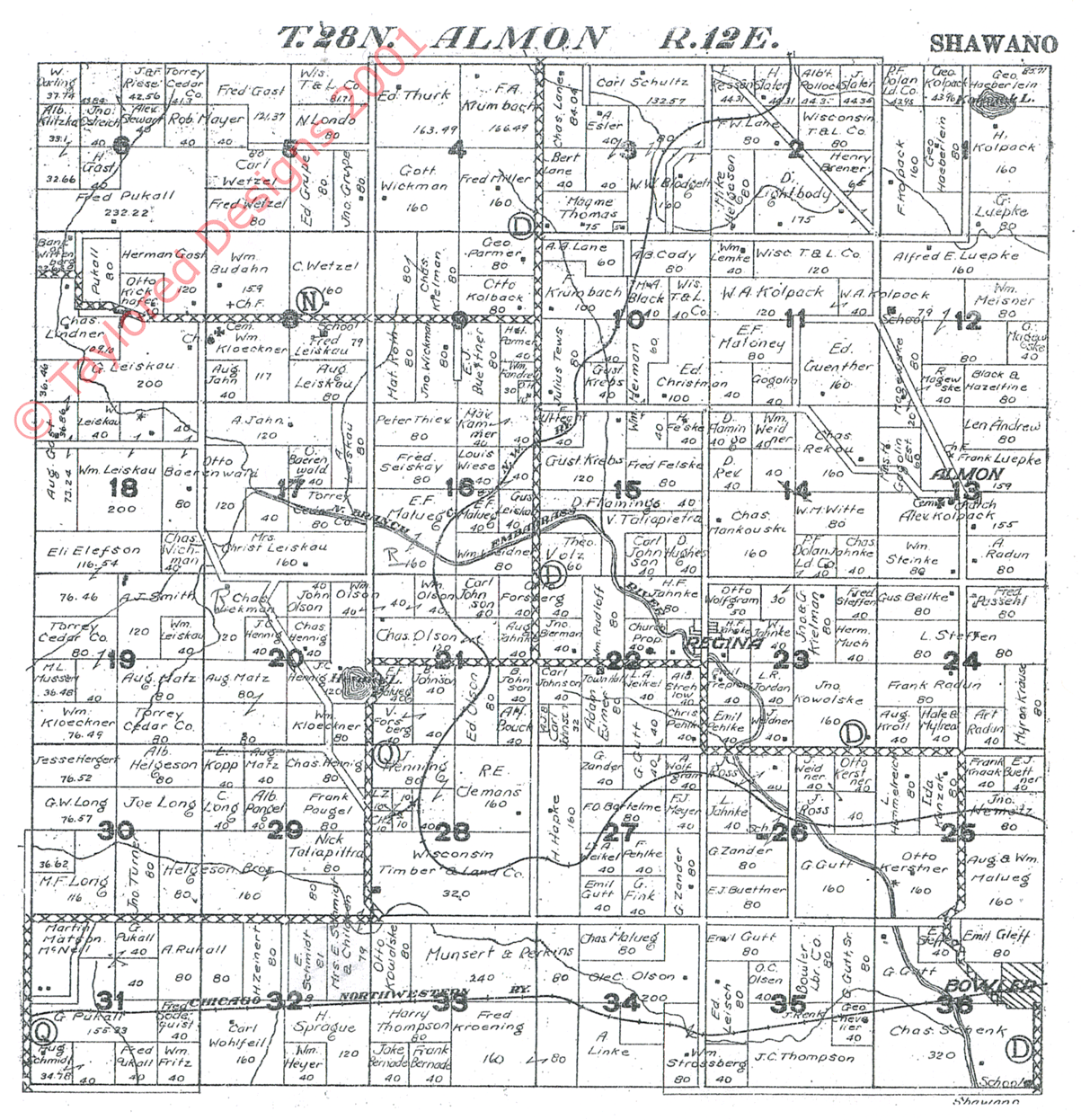
The ALMON TOWNSHIP map may take a while to load and is best viewed "maximized" computer screen width. I decided to keep the maps LARGE so that the names & details are easily read. This feature allows you to print the map FOR YOUR OWN PERSONAL USE.
AS YOU CAN SEE, WE NEED VOLUNTEERS TO INDEX THESE MAPS -- I CAN PROVIDE LARGER MAPS TO MAKE THIS EASIER ON THE EYES IF NEEDED.
If you have plat maps xeroxed, prior to 1930, and would like to share them, let me know! These maps can be a GREAT resource for land deeds when doing research & trying to locate those elusive relatives. The "key" at the bottom lists landowner and remember, plat maps are generally FARMLAND MAPS. ENJOY!
 |
 |
||
| SECTION 1 | SECTION 2 | SECTION 3 |
| SECTION 4 | SECTION 5 | SECTION 6 |
| SECTION 7 | SECTION 8 | SECTION 9 |
| SECTION 10 | SECTION 11 | SECTION 12 |
| SECTION 13 | SECTION 14 | SECTION 15 |
| SECTION 16 | SECTION 17 | SECTION 18 |
| SECTION 19 | SECTION 20 | SECTION 21 |
| SECTION 22 | SECTION 23 | SECTION 24 |
| SECTION 25 | SECTION 26 | SECTION 27 |
| SECTION 28 | SECTION 29 | SECTION 30 |
| SECTION 31 | SECTION 32 | SECTION 33 |
| SECTION 34 | SECTION 35 | SECTION 36 |
 © Taylored Designs 2010 All rights reserved. |
Nauert 24 666666