These are some of my favorite map and gazetteer links.
Email me your favorites and we'll post
them here.
 |
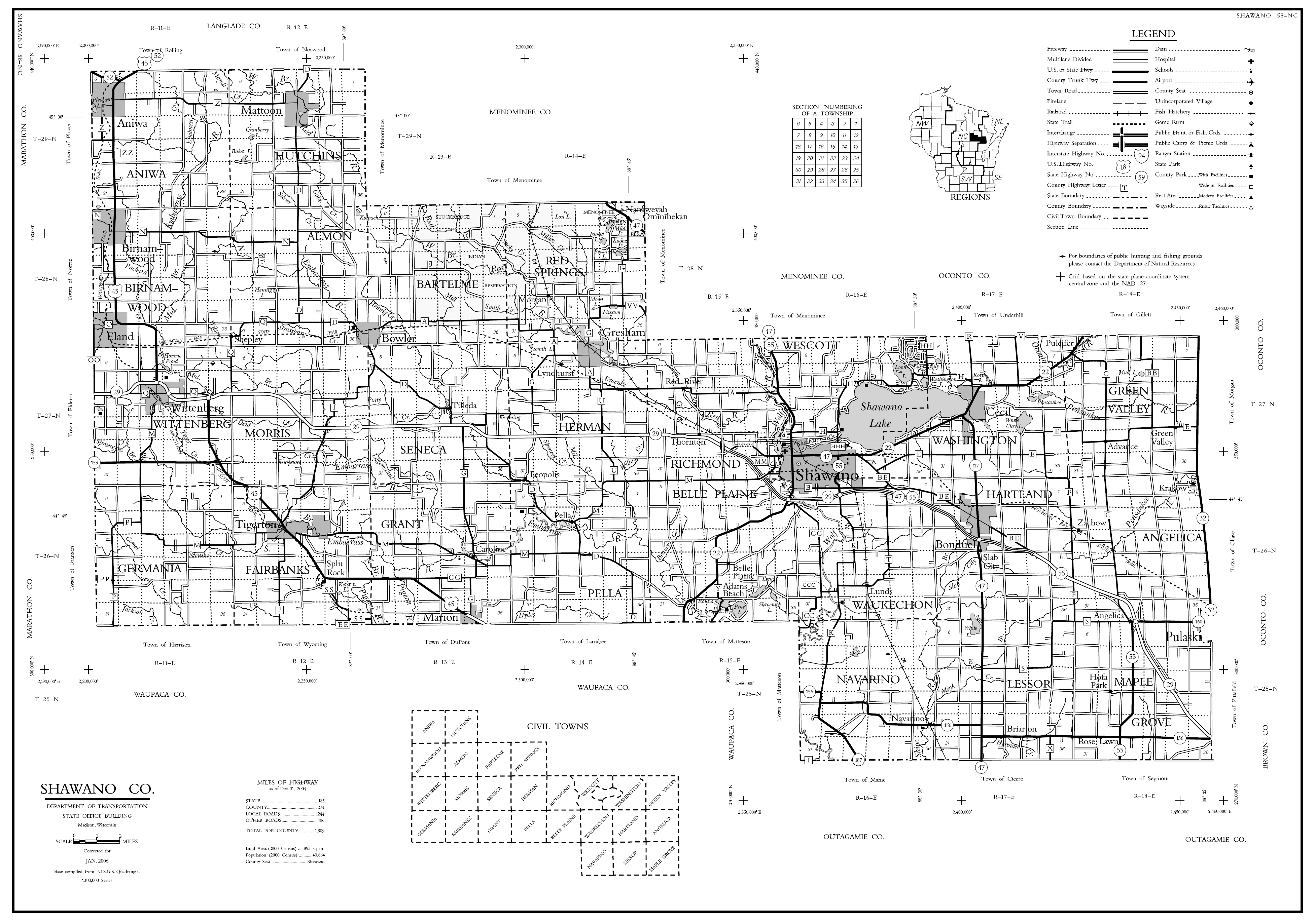
Shawano County DOT MAP - CURRENT and VERY, VERY DETAILED! -- this was
sent in by John Pejza. Here is also the link for the
page on the
WI Dept.
of Transportation Map site -- they have a map for each county there!
AWESOME SITE! Many thanks John for the great tip! |
|
|
Shawano County Townships
-- this was requested by one of the researchers and
this was what I came up with. If you have a better one, please email
it in! |
|
|
Wisconsin
Formation Map -- thanks Brian for the great link. You can see the
order in which the Wisconsin Counties were organized. |
|
|
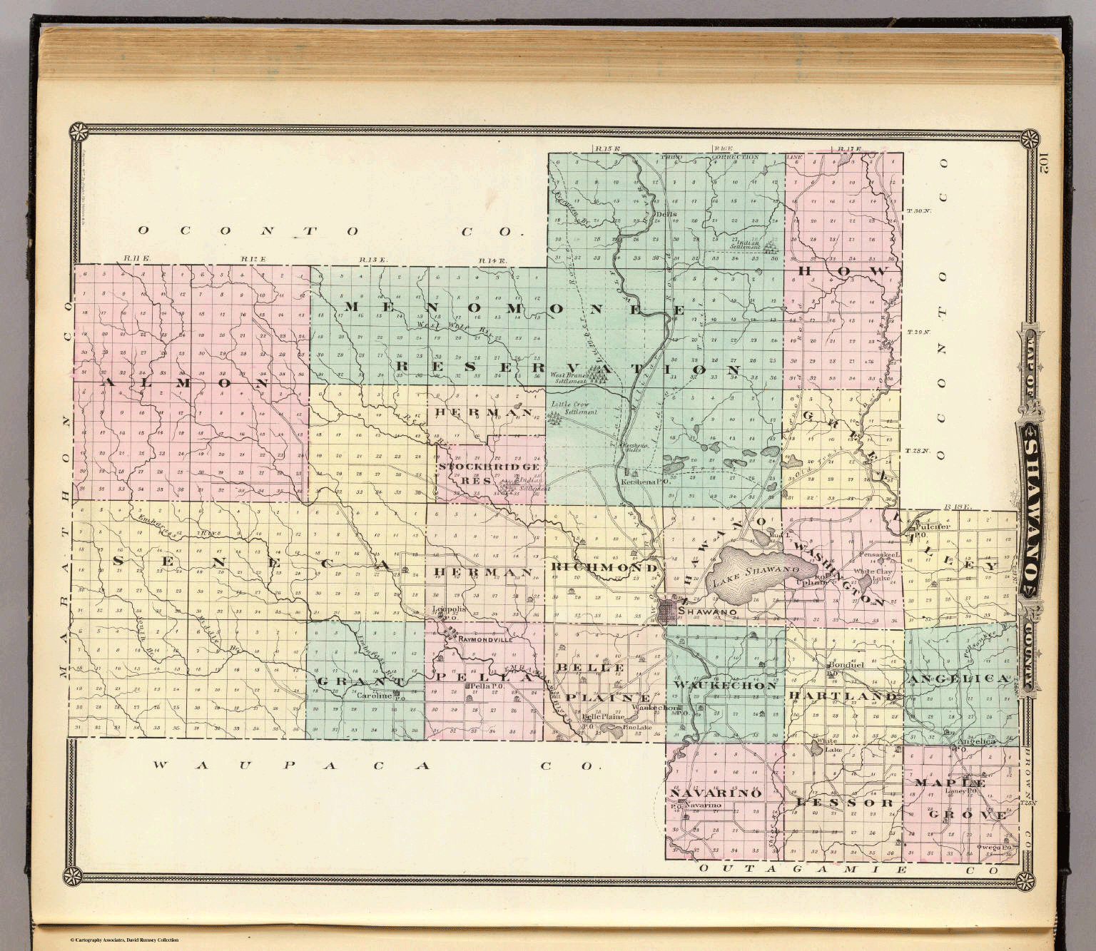
1878 Shawano County Township Map -- this
map shows the layout of the older townships. Notice the boundaries of the
adjacent counties, especially Oconto County. The 1878 townships included: Almon,
Herman, Stockbridge Res., Menominee Res., Green Valley, Seneca, Grant, Pella,
Richmond, Belle Plaine, Shawano, Washington, Waukechon, Navarino, Hartland,
Lessor, Maple Grove and Angelica. |
|
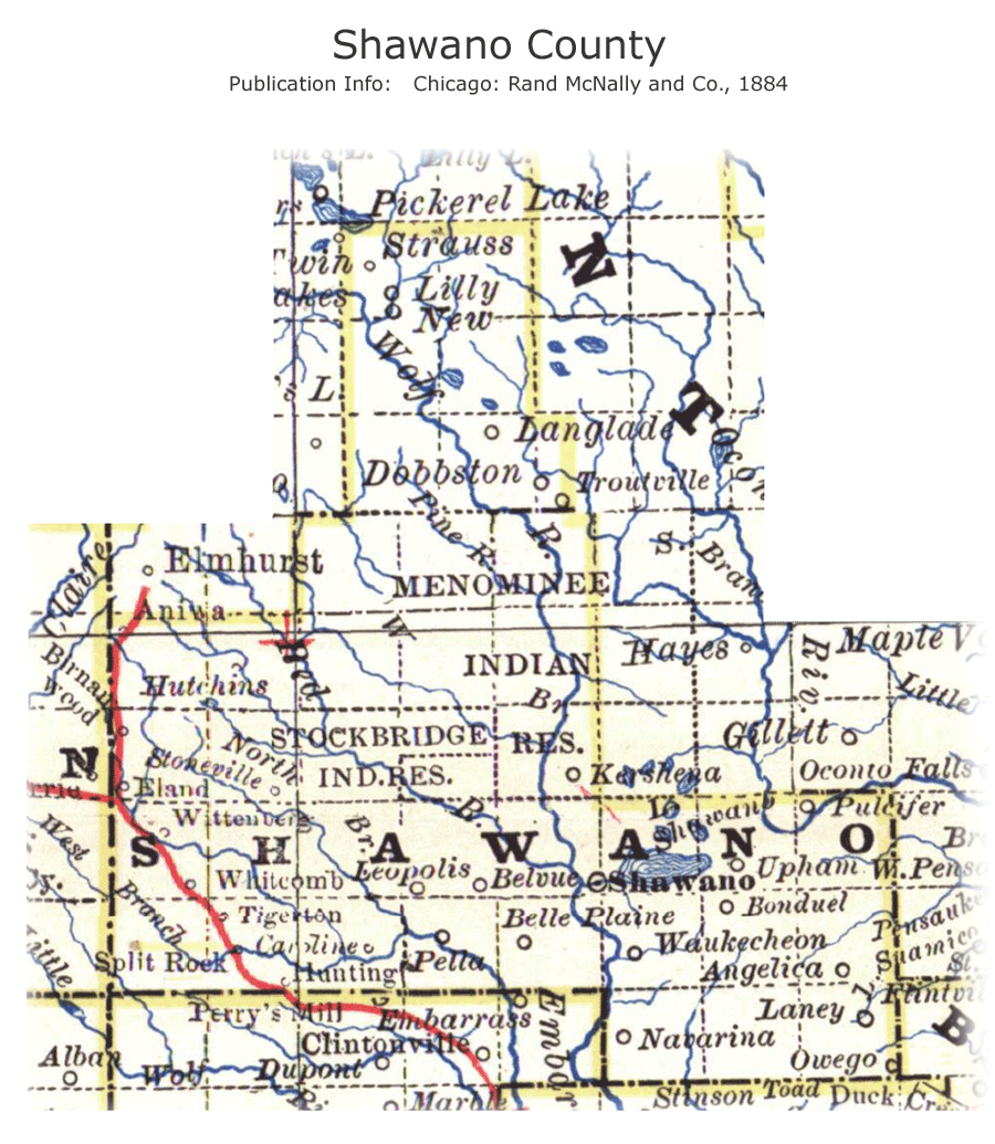
1884
Shawano County Map |
|
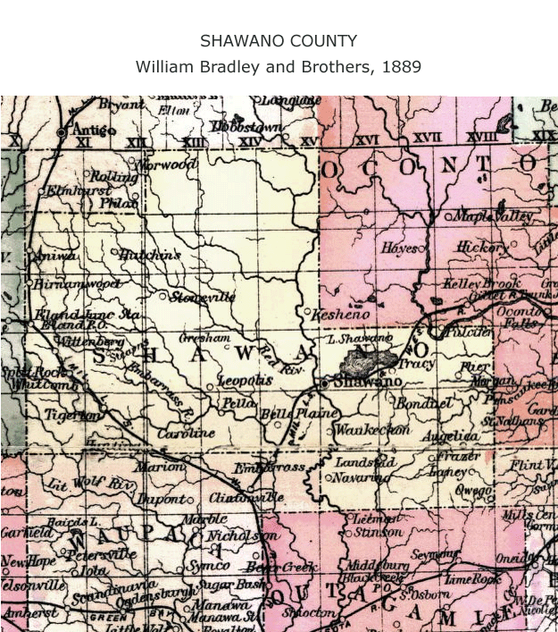
1889 Shawano
County Map |
|
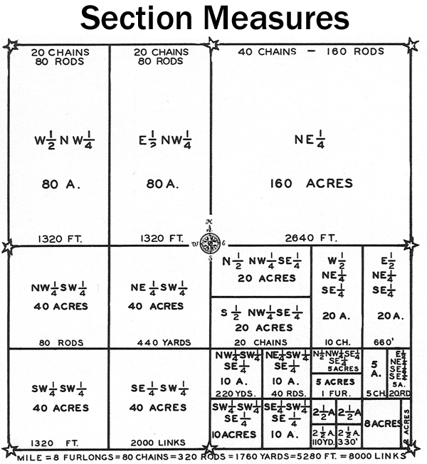
Plat Map Section
Divisions / Acreage / Neat Chart!
Hubby grew up in Chgo -- they measure land in FEET... I grew up in Bonduel -- we
measure in ACRES... this shows the conversion rate and explains ACRES & SECTIONS
and feet, links, rods, chains, yards, etc. |
|
1898 Shawano County Plat Maps |
|
1899
Shawano County Railroad Map |
|
1904 Shawano
County Map |
|
1911 Shawano County Plat Maps |
|
1920 Shawano County Plat Maps |
|
1924 Shawano County Plat Maps
- possibly a mislabeled version of 1920 but this copy is VERY CLEAR. |
|
Circa 1930's Plat Map - coming soon |
|
1947 Shawano City
Directory |
|
|
1960 Shawano County Plat
Maps |
|
|
1963 Shawano City
Directory --
work in progress! |
|
|
2006 Shawano County Plat Map -- we're
not able to post this per US copyright law but if you need a look-up,
email me. |
|
|
Wisconsin
Gazetteer 1853 -- EXCELLENT for finding towns and villages in 1853
Wisconsin. Takes a while to load, but well worth the wait. |
|
|
Cities &
Counties in Wisconsin -- Lists the towns and counties in the state. |
|
|
1891 Wisconsin State Map |
|
|
1895 Atlas Wisconsin
-- Good map, the wait in download time is well worth it. |
|
1901
Shawano County Map |
|
Wisconsin County Outline Map
-- County boundaries and names. U.S.
Bureau of the Census, 1990 |
|
1944
Wisconsin State Map |
|
County
Atlases -- Reference--explanation of various atlases available
at the State Historical Society of Wisconsin |
|
|
Using
Maps in Genealogy -- A good reference page |
|
Rivers of Wisconsin |
|
|
Wisconsin Territory Map 1832 - 1858 |
|
1915 Wittenberg Township Plat Book
Map |

