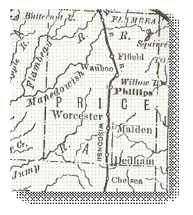
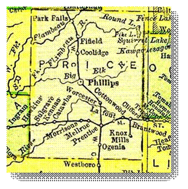
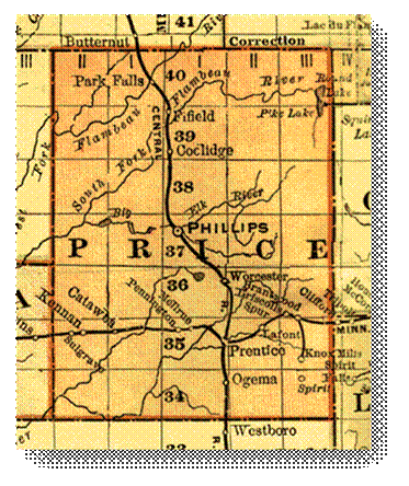
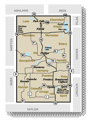
WIGenWeb

Price Co WI

USGenWeb Logo


Home

Announcements

Cemeteries

Census

Churches

Cities, Communities & Villages

County Information

Funeral Homes

Genealogies

Guest Book

Libraries

Maps

Pensioners

Photos

Queries

Strays

Surnames

Surnames: 1881

Surnames: 1905-06

Towns

Veterans

Vital Records


Resources:

   Mailing List

   Links

   Lookups

   WIGenWeb

   USGenWeb


Maps


MAP_1881.jpg

1881 – Price County

© Copywrited. History of Northern Wisconsin


PLATT BOOK: TOWN OF KNOX

T. 35 N. / R. 3 E.

Click on photo for larger view:

1910

1957

 MAP_1895 Price County.jpg

1895 – Price County

© Copywrited. Map image used with permission and courtesy of:

 Livingston County MI - Historical & Genealogical Project


PLATT BOOK: PRICE COUNTY

Click on photo for index page:

post-1920

MAP_1901 Price County.gif

1901 - Price County

©Copywrited. Map image used with permission and courtesy of: KinQuest.com


PLATT BOOKS: PRICE COUNTY

Click on title for pdf image:

189? - Part 1

189? - Part 2

1910 - Part 1

1910 - Part 2

1920 - Part 1

1920 - Part 2

1924 - Part 1

1924 - Part 2

1950 - Part 1

1950 - Part 2

1957 - Part 1

1957 - Part 2

Copies of the Price County Platt Books were donated by Kim Potaracke, Archaeological Technician/Passport in Time Coordinator with the Chequamegon-Nicolet Nation Forest Service. Many thanks to her!!!


Map of Price County.gif

2007 – Price County

© Copywrited. Map image used with permission and courtesy of: First Weber Group


FamilyHistory101.com has an excellent page that shows the formation of all Wisconsin counties from 1790 - 1961.

Visit their site at: http://www.mywisconsingenealogy.com/wi_maps/wi_cf.htm


Links:

Wisconsin Historical Aerial Image Finder

Wisconsin Land Economic Inventory Maps (Bordner Survey)

For additional information on families in Price County, you may want to consider purchasing, or obtaining from your local library or historical society, the following book: Family Maps of Price County, Wisconsin, Deluxe Edition, by Boyd, Gregory A., Arphax Publishing Company. “The book includes 3 maps for each of the 35 Congressional townships that make up Price County. Each Township has a Patent Map, Patent Index, Road Map, and a Map we call an Historical Map, which includes Waterways, Watercourses & Railroads. The Road and Historical Maps also include the City-centers and cemeteries that can be found at NationalAtlas.gov. There is also a Surname/Patent Index and a Surname/Township Index to help you dive into the right area of the County. Included Appendices identify multi-Patentee buying groups and also list the numerous Aliquot (section) parts you might find. This book is constructed to last with a plastic spiral binding, acid-free paper, and a tough, laminated cover.”  http://www.arphax.com/Price-WI

 If you have any information you would like to contribute, please contact the County Coordinator.


.

last edited

09 Mar 2014 

Copyright Notice: All files on this site are copyrighted by their creator. They may be linked to but may not be reproduced on another site without specific permission from Tami Lorbecke [tlorbeck@hotmail.com] or their contributor. Although public information is not in and of itself copyrightable, the format in which they are presented, the notes and comments, etc., are. It is however, quite permissible to print or save the files to a personal computer for personal use ONLY.