|
Location and nearest intersection |
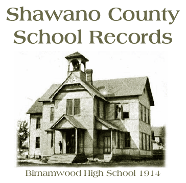
School name and information |
|
Town of Aniwa, T29N, R11E |
|
SE 1/4, NE 1/4, Sec. 7
1st St., Village of Aniwa |
Aniwa School, District No. ?
Closed about 2004. |
|
NE 1/4, NE 1/4, Sec. 10
County Highway "Z" and Sugarbush Road |
Sandy Lane School, District No. ? |
|
SE 1/4, NW 1/4, Sec. 26
Cherry Road and White Birch Road |
Middle Branch School, District No. ? |
|
SW 1/4, NW 1/4, Sec. 29
State Highway "45" between Hill Road and Phoebe Lane |
Midway School, District No. ? |
|
Town of Hutchins, T29N,
R12E |
|
NE 1/4, SE 1/4, Sec. 7
County Highway "Z" |
Shelley's School, District 3?
Different name before 1930? |
|
Sec. 10 |
Village of Mattoon
Mattoon Grade School, District 2? |
|
NW 1/4, SE 1/4, Sec. 11
Hillview Road and Swamp Road |
Name & District No. ? |
|
SE 1/4, NE 1/4, Sec. 26
Spring Road and Red River Road |
Shady Nook, District 6? |
|
NE 1/4, SE 1/4, Sec. 30
Woodlawn Road and Hemlock Lane |
Lake May, District 4 |
|
NE 1/4, NE 1/4, Sec. 33
County Highway "D" and Willow Road |
Sunnyvale, District 5? |
|
Town of Birnamwood, T28N,
R11E |
|
Sec. 6
Village of Birnamwood |
Birnamwood School |
|
NE 1/4, NE 1/4, Sec. 10
County Highway "N" and River Road |
Balsam Grove School, District No. ?
latitude: 44.92778
longitude: -89.14333 |
|
Sec. 31
Village of Eland |
Eland School |
|
NE 1/4, SE 1/4, Sec. 35
Shepley Road and Raspberry Road |
Shepley School? District No. ? |
|
Town of Almon, T28N, R12E |
|
NW 1/4, SE 1/4, Sec. 8
County Highway "N" between River Road and Maple Road |
Leiskau School, District No. ? |
|
SW 1/4, NW 1/4, Sec. 12
Kolpack Road and Tower Road |
Kolpack School, District No. ?
latitude: 44.92111
longitude: -89.00139 |
|
NE 1/4, SE 1/4, Sec. 26
First Bldg? At center of Section. 1911 icon might be in wrong place or
building location changed. No road through this section today! Topo map NW
1/4, NW 1/4 & now town hall. Regina Road and Hilltop Road. |
Regina School, District No. ? |
|
SW 1/4, SW 1/4, Sec. 28
County Highway "Q" and Sand Road. Near Mattoon Junction. |
Henning School, District No. ?
latitude: 44.8725
longitude: -89.06167 |
|
SE 1/4, SE 1/4, Sec. 36
County Highway "D" and Town Line Road |
Bowler School |
|
Town of Bartelme, T28N,
R13E |
|
No historical schools found on topographic
maps. |
No schools found in 1911 plat book. |
|
Town of Red Springs,
T28N, R14E |
|
SW 1/4, SE 1/4, Sc. 23
Mission Lake Road and E.W. Town Hall Road |
Name & District No. ? |
|
NE 1/4, SE 1/4, Sec. 26
County Highways "G" and "VV" |
El Mohican School, District No. 2
latitude: 44.8775
longitude: -88.76028 |
|
NW 1/4, NE 1/4, Sec. 29
Morgan Road and E.W. Town Hall Road |
Morgan Siding School? District No. ? |
|
Town of Wittenberg, T27N,
R11E |
|
NE 1/4, SW 1/4, Sec. 2
Maple Road between County Highway "Q" and Hemlock Road? |
Hidden Valley, District No. ?
latitude: 44.84778
longitude: -89.13333 |
|
SE 1/4, NW 1/4, Sec. 8
Killdeer Road between State Highway "29" and Hemlock Road |
Wayside School, District No. ? |
|
Sec. 16 |
Was there a school in the Village of
Wittenberg? |
|
SW 1/4, SW 1/4, Sec. 12
State Highway "29" and Spruce Road |
Name & District No.? |
|
SW 1/4, NW 1/4, Sec. 20
Meadow Lane and Elm Road |
Sunnyside School, District No. ? |
|
SW 1/4, SW 1/4, Sec. 25
State Highway "153" and Blueberry Road |
Whitcomb School District No. ? |
|
NW 1/4, NW 1/4, Sec. 33
State Highway "153" and County Highway "M" |
Name & District No. ? |
|
Town of Morris, T27N,
R12E |
|
NE 1/4, NE 1/4, Sec. 18
State Highway "29" and Banner Road |
Name & District No. ? |
|
SW 1/4, NW 1/4, Sec. 23
State Highway "29" and County Highway "U" |
Norway School, District No. ? |
|
SW 1/4, SW 1/4, Sec. 26
On Church Road between Holm Lane and Loken Road. |
Loken School, District No. ? |
|
Town of Seneca, T27N,
R13E |
|
NE 1/4, NE 1/4, Sec. 11
Mill Creek Road and Roosevelt Road. |
Range Line School, District No. ? |
|
Sec. 15 |
Was there a school in Tilleda? |
|
NW 1/4, SW 1/4, Sec. 20
State Highway "29" and Maple Lane |
?
Map has asterisk & icon. Not sure which location? Location might be NE
1/4, SE 1/4, Sec. 19? Name & District No. ? |
|
NW 1/4, SW 1/4, Sec. 25
County Highway "D" and Zimdars Road |
Name & District No. ? |
|
Town of Herman, T27N,
R14E |
|
NE 1/4, SE 1/4, Sec. 1
Juniper Road and Butter Nut Road |
Peters Hall School, District No. ? |
|
Sec. 3 |
Was there a Gresham School? |
|
NE 1/4, SE 1/4, Sec. 18
Mill Creek Road and County Highway "G" |
Hohn School, District No. ?
latitude: 44.81833
longitude: -88.83778 |
|
NW 1/4, NW 1/4, Sec. 26
State Highway "29" and County Highway "U" |
Hermansfort School, District No. ?
Now Town
Hall
latitude: 44.79417
longitude: -88.77556 |
|
Sec. 31 |
Was there a Leopolis School? |
|
Town of Richmond, T27N,
R15E* |
|
SW 1/4, SW 1/4, Sec. 4
Beech Road and Butternut Road |
Texas School?, District No. ? |
|
SE 1/4, SW 1/4, Sec. 11
On Balsam Road between County Highway "A" and Broadway Road |
Forest School
latitude: 44.82722
longitude: -88.64639 |
|
NW 1/4, NE 1/4, Sec. 17
County Highway "A" and Cypress Road |
Red River School District No. ? |
|
SE 1/4, SW 1/4, Sec. 19
State Highway "29" and Spruce Road |
Name & District No. ? |
|
SE 1/4, NE 1/4, Sec. 26
On Oak Road between Locust Road and Poplar Road |
Pine Grove School, District No. 6 |
|
SE 1/4, SE 1/4, Sec. 33
County Highway "M" and Maple Road |
Name & District No. ? |
|
Town of Wescott, T27N,
R16E* |
|
SE 1/4, NW 1/4, Sec. 7
Montoure Road and Raguse Road |
Oak Park District No. ? |
|
NE 1/4, SE 1/4, Sec. 10
County Highway "H" and Park Ave. |
Name & District No. ? |
|
SW 1/4, SE 1/4, Sec. 28
State Highways "29" and "22" |
Name & District No. ? |
|
SE 1/4, NW 1/4, Sec. 30
City of Shawano |
Ainsworth School |
|
Town of Washington, T27N,
R17E* |
|
NE 1/4, NE 1/4, Sec. 10
County Highway "V" and Lily Pond Road |
Name & District No. ? |
|
Sec. 20 |
Was there a school in village of Cecil? |
|
NE 1/4, SE 1/4, Sec. 26
On County Highway "E" between Lodge Road and Fawn Road |
Name & District No. ? |
|
NW 1/4, NW 1/4, Sec. 31
County Highway "E" and Lakeview Road |
Name & District No. ? |
|
Town of Green Valley,
T27N, R18E* |
|
NE 1/4, NE 1/4, Sec. 8
County Highway "C" and Church Road |
Name & District No. ? |
|
NW 1/4, SW 1/4, Sec. 23
County Highway "BB" and Nauman Road |
Green Valley School? |
|
Town of Germania, T26N,
R11E |
|
NW 1/4, SW 1/4, Sec. 4
County Highway "M" and Larson Road |
Name & District No. ? |
|
NW 1/4, SE 1/4 Sec. 11
On Spring Road between "M" and Beetle Creek Road |
Name & District No. ? |
|
SW 1/4, NE 1/4, Sec. 24
On Mile Road between Tower Road and Comet Road |
Name & District No. ? |
|
NW 1/4, SW 1/4, Sec. 27
Comet Road and Much Road |
Name & District No. ? |
|
Town of Fairbanks, T26N,
R12E |
|
Secs. 8,9,16,17 |
Village of Tigerton School |
|
SW 1/4, SE 1/4 Sec. 11
County Highway "M" and Schertz Lane |
Name & District No. ? |
|
SE 1/4, SE 1/4, Sec. 23
State Highway "45" and Lone Maple Road |
Name & Sub-District No. 11 |
|
SE 1/4, SW 1/4, Sec. 28
Split Rock Road and Alft Lane |
Name & District No. ? |
|
NE 1/4, SE 1/4, Sec. 35
County Highways "SS" and "EE" |
Name & District No. ? |
|
Town of Grant, T26N, R13E |
|
NW 1/4, NE 1/3, Sec. 5
On Weasel Dam Road 1/4 mile north of Breitenfeldt Road |
Weasel Dam School, District No. ? |
|
NE 1/4, SE 1/4, Sec. 17
County Highway "M" and Haase Road |
Name & District No. ? Not sure if public or
church school? |
|
SE 1/4, NW 1/4, Sec. 23
On County Highway "G" between Buss Road and County Highway "M" |
Caroline School, District No. ? |
|
SW 1/4, NE 1/4, Sec. 31
Burma Road and unknown road |
Name and District No. ? |
|
SW 1/4, NE 1/4, Sec. 34
On Gollnow Road just west of State Highway "45" |
Name and District No. ? |
|
Town of Pella, T26N, R14E |
|
NW 1/4, NW 1/4, Sec. 1
County Highway "M" and Will Creek Road |
Willow Creek School, District No. ? |
|
Sec. 9 |
Possibly Smithville School
(Marion?) Thanks, Mark Mehlberg |
|
SE 1/4, SE 1/4, Sec. 20
Elm Grove Road and Fairview Road |
Fairview School, District No. 3
(Marion?) Thanks, Mark Mehlberg |
|
SE 1/4, SW 1/4, Sec. 24
County Highway "D" and River Bank Road |
Name and District No. ? |
|
SW 1/4, NE 1/4, Sec. 36
On Pella Opening Road between County Highway "DD" and Apple Road |
Not sure if public or church school? |
|
Town of Belle Plaine,
T26N, R15E |
|
SW 1/4, SE 1/4, Sec. 6
Spruce Road and Angle Road |
Boersdorf School, District No. ?
latitude: 44.75167
longitude: -88.71889 |
|
SW 1/4, SW 1/4, Sec. 10
On Pineridge Road just north of County Highway "Y" |
Name and District No. ? |
|
NE 1/4, SE 1/4, Sec. 11
County Highway "Y" and Rose Brook Road |
Name & District No. ? |
|
NW 1/4, SE 1/4, Sec. 20
On Pioneer Road between Evergreen Road and Friendship Road |
Name and District No. ?
See Series 11, 1922 Census Records |
|
SE 1/4, NE 1/4, Sec. 26
Schoenrock Lake Road 1/2 mile south of St. John's Church Road |
Name & District No. ? |
|
SW 1/4, NW 1/4, Sec. 32
River Bank Road and County Highway "22" |
Name & District No. ? |
|
Town of Waukechon, T26N,
R16E |
|
SE 1/4, NE 1/4, Sec. 2
Hill Crest Road and Castle Road |
Name & District No. ? |
|
SW 1/4, NE 1/4, Sec. 5
On Lime Kiln Road between Pit Road and State Highway "187" |
Dallman School, District No. ?
latitude: 44.76056
longitude: -88.57222 |
|
NW 1/4, NW 1/4, Sec. 14
Porter Road and County Highway "T" |
Name & District No. ? |
|
NE 1/4, NE 1/4, Sec. 18
On County Highway "CC" 1/2 mile north of Meadow Lane |
Name and District No. ? |
|
SE 1/4, SW 1/4, Sec. 23
On Sunrise Road between County Highway "T" and Brook Road |
Name and District No. ? |
|
NW 1/4, NW 1/4, Sec. 32
Cloverleaf Lakes Road and County Highway "CC" |
Riverside School?, District No. ? |
|
Town of Hartland, T26N,
R17E |
|
SE 1/4, NW 1/4, Sec. 8 |
Village of Bonduel |
|
SE 1/4, NW 1/4, Sec. 15
On State Highway "45" between North Highland and Hilltop Lane |
Name & District No. ? |
|
SW 1/4, SW 1/4, Sec. 21
State Highway "47/55" and Dump Lane |
Name & District No. ? |
|
NE 1/4, SE 1/4, Sec. 23
On South Broadway 1/4 mile south of State Highway "29" |
Name & District No. ? |
|
Town of Angelica, T26N,
R18E* |
|
SW 1/4, SW 1/4, Sec. 5
Beech Road and Carroll Road |
Name & District No. ? |
|
NW 1/4, NW 1/4, Sec. 7
On County Highway "F" 1/4 mile south of Beech Road |
Name & District No. ? |
|
SW 1/4, NE 1/4, Sec. 10
Elm Road and Cuba Drive |
Name & District No. ? |
|
NE 1/4, SE 1/4, Sec. 17
On Church Road between Cedar Road and County Highway "C" |
Lincoln
School (log school house)
Later, new school called La Follett |
|
SE 1/4, SE 1/4, Sec. 22
Town Hall Road and Elm Road |
Name & District No. ? |
|
NE 1/4, NE 1/4, Sec. 32
State Highway "29" and County Highway "C" |
Name & District No. ? |
|
Town of Navarino, T25N,
R16E |
|
NW 1/4, NW 1/4, Sec. 4
Town Line Road and Wildwood Road |
Name & District No. ? |
|
NW 1/4, NW 1/4, Sec. 19
State Highway "187" and Lole Road |
Name & District No. ? |
|
NE 1/4, SW 1/4, Sec. 25
On County Highway "W" |
Village of Galesburg, now called Navarino. |
|
NE 1/4, NW 1/4, Sec 28
On Erb Road 1/2 mile west of County Highway "W" |
Name & District No. ? |
|
Town of Lessor, T25N,
R17E |
SW 1/4, SE 1/4, Sec. 1
Located in the extreme NE corner (Bena Jeske farm). |
Frazer Corners or Lessor
State Graded School
(Thanks, Howie) |
|
SW 1/4, SE 1/4, Sec. 4
On Landstad Road 1/2 mile east of State Highway "47/55" |
Name & District No. ? |
SW 1/4, SE 1/4, Sec. 11
Located in the extreme SE corner
(listed on plats as church land) |
Welhaven Grade School
(Thanks, Howie) |
|
SE 1/4, SE 1/4, Sec. 25
County Highway "W" and Lawn Road |
Name & District No. ? |
|
SE 1/4, SW 1/4, Sec. 27
County Highway "W" 1/4 mile east of State Highway "47/55" |
Name & District No. ? Near Briarton |
|
NE 1/4, SW 1/4, Sec. 29
County Highway "W" and Mapleview Road |
Name & District No. ? |
|
Town of Maple Grove,
T25N, R18E* |
|
NE 1/4, NE 1/4, Sec. 1
Village of Pulaski, in 1911 part of Shawano County. |
Village of Pulaski School |
|
SW 1/4, NW 1/4, Sec. 13
On Green Valley Road 1/4 mile south of Golden Rod Road |
Name & District No. ? |
|
NE 1/4, NW 1/4, Sec. 15
N1675 Laney Road |
Laney School, District No. ? Now Town Hall.
National Registry of Historic Places #98001463. |