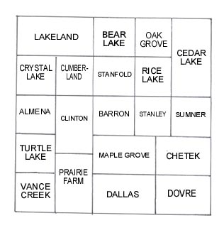
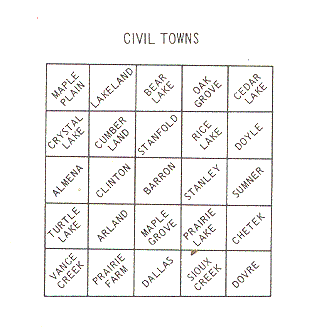
The present day boundaries of Barron County, Wisconsin were finalized in 1874. Until that date, surrounding counties claimed parts of Barron County. The townships underwent changes until they reached their current organization in 1929. There are 25 townships within the county today, and each township is divided into 36 sections. The following maps show the changes between the 1903 township boundaries and the current township boundaries:
 |
 |
Nothing has been assumed when extracting the names from this atlas. Therefore, J. J. Smith and John J. Smith may be the same person, but will be treated as separate entities. Likewise, no assumptions have been made regarding the spelling of names. It is suggested that you search under any possible spellings. Consider not only what sounds similar, but also how letters may have appeared similar when written. Also note that multiple sections owned by a landowner are separated with a forward slash (/).
If you find a surname which looks to be related to your search, it is suggested that you follow-up your research at other sources in the county. The Barron County Courthouse, the Rice Lake Public Library, the LDS Family History Center and, during the summer months, the Barron County Historical Museum may each help you to further your research.
Click on the letter of interest to you:
A B C D E F G H I J K L M N O P Q R S T U V W X Y Z
Last Update